Archive for the ‘tech’ Category

My iPhone’s been tracking me!


There’s been a lot of news lately about the discovery that the iPhone has kept a location history of its travels. I of course jumped on the opportunity to see where I’ve been.

And what do you know, I spend most of my time around Boston! Nothing unexpected, driving to VT, NH, CT and PA. I spent a few days in New Orleans last summer. It even managed to pick up my flight connections there, in Philly and Charlotte! My trip to France and Germany is well documented as well. And then there are a few random dots around the country (not visible here) when cell towers as misidentified. download the tool and try yourself!

Latitude

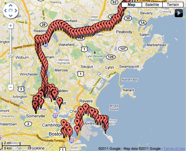
The Google Latitude iPhone app recently updated with more efficient battery usage while running in the background so I’ve been running it this week to see how well it works. Impressively I barely notice a difference to my battery life most of the day when I am at home or work, Google must slow GPS updates when it knows I haven’t moved for a while. On a computer, you can search your history – the photo above shows my activity for the last few days. Unfortunately the iPhone version still does not have auto-check in. It sure would be nice for it to automatically check you in not only on Google but Foursquare, Facebook, Yelp, and the rest of them. It’s all just another not very useful but fun feature of Google/iPhone.

Commuting in the Snow

Last friday was one of several snowy commutes that I’ve had in January, and I realized my normal dash mount allowed the iPhone’s camera a view of the road. So I recorded a few clips, if you feel like experiencing the crawl of traffic with me.

The video was shot vertically in portrait mode, as my iphone normally sits there running INRIX Traffic while driving. I was wondering what effort I would need to go through to rotate and crop the video, which is beyond the capabilities of iMovie on the computer. But a new free iPhone video editing app just came out that allowed me to do so very easily: Splice. In fact I’d say it is easier to use than iMovie for iPhone. Sadly it is currently prone to bugs and crashes (you MUST add transitions to get around export errors). But the price is right, and I’m sure it will be improved soon. It’s great to be able to shoot and edit together clips without ever leaving your phone-in fact 720tube lets you upload in full resolution, so there’s truly no need for a computer.

Snowstorm in 1080p

Today’s storm had 1-2 feet of wet, heavy snow and most of Boston stayed home to wait for it to end. Between the sounds of icey-snow-covered tree branches smacking the house, I awoke to the eerie silence of no traffic outside except for the occasional bus or plow. I spent almost the entire day shoveling out. I took the opportunity to take some video with my Canon T2i, also to test out the Magic Lantern firmware hack with its useful extra features. Watch the video on YouTube to see it in full HD resolution.

Heat Camera

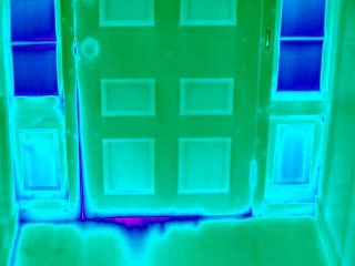
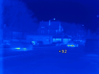
While temperatures were in the teens one night this week, I took the opportunity to bring the thermal imaging camera home from work and take a bunch of boring pictures of doors, windows, and walls to see where cold might be leaking in:

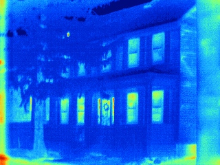
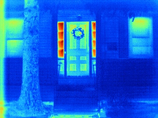
I took some more interesting pictures too. Here’s the house from the outside:

You can see the old single paned glass next to the door doesn’t insulate well.

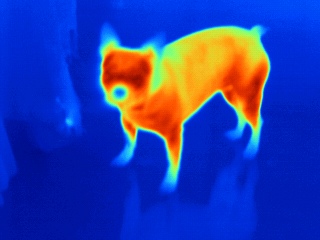
Jezi has a cold nose:

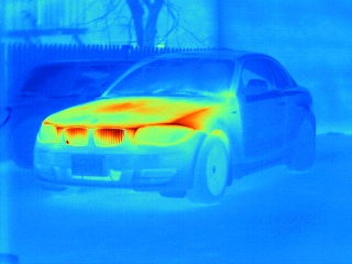
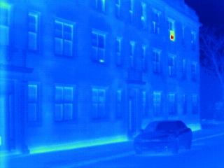
The car was driven a few hours before, some of the body is still warm:

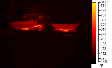
Dinner cooking with 500-degree flame, warm food being served:

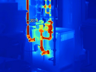
You can tell which zone is running on the furnace, and see the hot exhaust going up (and to the side!) of the chimney upstairs:

Hot exhausts on cars driving by, and an open window in the apartments next door:

Geotagging with PlaceTagger

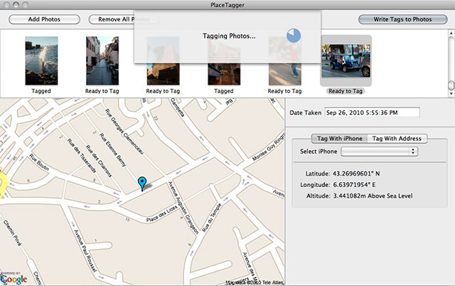
Many modern photo gallery sites (as well as my own) now support geotagged photos–displaying where exactly they were taken on a map. Very few cameras, however, have a built-in GPS. For years I had considered getting a specific gadget for doing so, for $100-200 it is essentially a small GPS logging device that you later sync with software on your computer that matches up the time of each photo to find where it was taken and adds that information. But with the iPhone, you already have all you need.

PlaceTagger was one of the first iPhone apps to do this, and I grabbed it when it debuted a few years ago, but had only used it occasionally. Last month’s trip to Europe was the perfect opportunity to record the location of the hundreds of photos that I took. With the iPhone 4, PlaceTagger barely uses any battery either, about 5% per hour, and runs nicely in the background.

Typically the computer PlaceTagger app finds your iphone on the same network and works very easily to find its data. However I came across some trouble thanks to changing time zones. After some research, it turns out that PlaceTagger records time in GMT, then assumes the camera is set to the time zone of your computer. Of course that wasn’t true with my home computer. I had to export an XML file with the date range, then search & replace the times to correct for it (in my case, setting everything 5 hours ahead). Had I left my camera set to EDT, I wouldn’t have had that trouble.

So as I slowly start adding my Europe photos to my galleries, be sure to look for the Map link in most photos to see where they were taken. Of course, the iPhone does this all automatically for any photos taken with its own camera.